
Timed radio signals from orbiting GPS satellites let your phone’s receiver calculate your position from their travel times. Your blue dot also draws on Wi-Fi, cellular towers, maps, and motion sensors, which explains why it can settle quickly outdoors yet drift inside a store.
You’ll learn how the hardware, distance math, offline limits, accuracy issues, battery use, and privacy settings shape location services on iPhone and Android phones.
The Receiver Listens for Satellite Signals
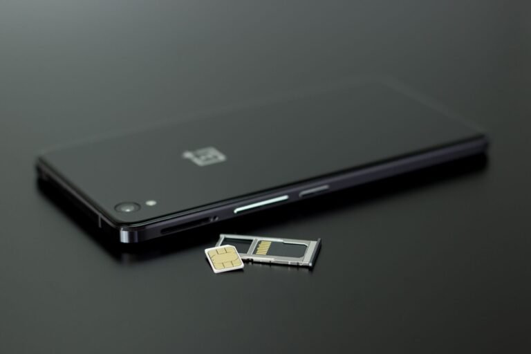
A small radio chip inside your phone listens to broadcasts from space, even without a SIM card. Modern iPhone and Android models contain this phone GPS receiver hardware, so your device can calculate a satellite position without an active cellular plan.
Your phone does not send a request toward satellites. It receives their broadcasts, much like a radio receives a station. That one-way signal path explains how GPS works without a SIM card and why your position can still appear in airplane mode under open sky.
GPS Belongs to a Larger Satellite Group
GPS refers to the Global Positioning System (GPS), a United States satellite system used for civilian positioning worldwide. GNSS (Global Navigation Satellite System) is the broader label for GPS, Europe’s Galileo, Russia’s GLONASS, China’s BeiDou, and related satellite systems.
Your handset can listen to several satellite constellations at once. More signals give your device more usable range measurements near trees, cliffs, and tall buildings that block part of the sky. Some models also receive Japan’s QZSS signals in parts of the Asia-Pacific region.
| Term | What it means for your phone |
|---|---|
| GPS | The United States satellite system used for positioning. |
| GNSS | The umbrella term for GPS, Galileo, GLONASS, BeiDou, and related systems. |
| Phone GPS receiver | The chip that listens to satellite broadcasts and calculates ranges. |
| Location services | Your phone’s software layer that blends satellite, network, and sensor data. |
Satellite reception carries no separate charge from your mobile carrier. Charges tied to mobile data, paid map features, or app subscriptions sit outside the satellite system. Your receiver’s next job is turning each faint broadcast into a distance measurement.
Signal Timing Reveals Satellite Distance
Each satellite transmits a digital message with three useful details: its identity, a precise transmission time, and orbital-position data. Your phone uses those details as a timestamped ruler stretching across roughly 12,000 miles of space.
Radio waves travel at about 186,000 miles per second. Your receiver checks the difference between transmission and arrival time, then multiplies that delay by the speed of light to estimate its distance from the satellite.
Travel Time Becomes a Measured Range
A delay of 0.07 second means a radio signal traveled about 13,000 miles before reaching your phone. That figure does not reveal whether you stand north, south, east, or west of the satellite. It only places you somewhere on the surface of a large invisible sphere.
Your phone repeats that calculation for every usable signal. Orbital data, called ephemeris data, tells the receiver where each satellite sat at transmission time. A small timing error turns into a large location error because radio signals move so quickly.
| Satellite broadcast item | How your phone uses it |
|---|---|
| Satellite identity | Links the received signal to a known source in orbit. |
| Transmission timestamp | Shows how long the signal traveled to your receiver. |
| Orbital-position data | Places the satellite in space for the range calculation. |
| Health and clock data | Helps your phone reject weak signals and correct satellite timing. |
Those expanding spheres explain why GPS relies on distance rather than direction. One range leaves countless possible points. More ranges shrink those possibilities until your phone can isolate a practical position.
Trilateration Locates Your Position
Distance circles on a flat map offer a useful visual, but your phone solves three-dimensional spheres. The method is called trilateration, not triangulation, because it intersects measured distances instead of measuring angles.
Three clean ranges could locate a point in theory, but only with a clock as accurate as the atomic clocks aboard navigation satellites. Smartphones do not contain atomic clocks. Their internal clocks drift too far for a three-satellite fix.
Four Satellite Ranges Correct Clock Error
A fourth satellite range supplies the missing clock correction. Your phone solves latitude, longitude, altitude, and its own clock error at the same time. That is why four satellite signals form the practical minimum for a reliable outdoor position.
Extra signals still matter after your phone reaches four. Additional ranges expose weak or reflected measurements, allowing the chip to reduce the influence of a troublesome satellite instead of trusting every signal equally.
A Six-Satellite Street-Corner Example
Six separate range measurements reach your receiver when satellites are visible above a street corner. The math selects the position that fits those measurements while correcting the clock error. A signal reflecting from a glass office tower can still pull your dot away from the sidewalk.
Your location dot is a calculated estimate, not a direct view from space. A map app displays the result after your phone filters imperfect measurements.
That filtering grows stronger after your handset adds network and sensor information. Open sky is not always available, especially inside buildings, beneath road overpasses, or between dense city blocks.
GNSS, Networks, and Sensors Speed Up Location
Sixteen visible GNSS satellites give your phone more choices than four GPS satellites alone. Galileo, GLONASS, and BeiDou add useful signals because a blocked view in one direction does not block every constellation.
Your location services also use Assisted GPS (A-GPS). Through cellular data or Wi-Fi, A-GPS supplies time and satellite orbit details, so your receiver spends less time gathering that information from weak broadcasts overhead.
Startup Data Changes the Wait
A cold start happens after your phone lacks recent orbit data, a reliable time estimate, or both. The receiver must gather fresh broadcast details before it settles on a position, so your outdoor wait can run longer.
A warm start uses stored orbit details and a rough recent position. Your device searches a smaller part of the sky, so it can regain a fix faster after a short pause than after a long trip with location services inactive.
- Cold start: Your receiver has little current satellite information and needs more time under open sky.
- Warm start: Recent orbit data gives your receiver a useful starting point for signal acquisition.
- Assisted start: Wi-Fi or cellular data supplies timing and orbit details before satellite reception finishes.
- Time to fix: This measures the wait between opening location services and receiving a usable position.
Sensor Fusion Bridges Short Signal Gaps
Wi-Fi positioning estimates your place from nearby network identifiers, while cellular tower positioning uses signal relationships across the mobile network. Bluetooth location services can add room-level clues in airports, stores, and large venues where satellite reception struggles.
Your compass supplies heading, the accelerometer senses movement, and the gyroscope detects rotation. Sensor fusion blends those inputs with GNSS ranges and map geometry, helping your car marker stay on the road through a short tunnel or underpass.
Google Maps and Apple Maps also use road shapes to make a moving marker look sensible. That visual adjustment can be useful, yet it does not alter the raw satellite calculation. The distinction matters after internet access disappears.
Satellite Positioning and Internet Serve Separate Jobs
Airplane mode does not stop your receiver from listening to satellites. With location services enabled and a clear sky view, your device can still calculate outdoor coordinates without cellular data or Wi-Fi.
A SIM-free phone works the same way for satellite reception. Internet access handles separate tasks, including address searches, live traffic, route changes, refreshed road data, location sharing, and A-GPS assistance.
| Phone task | Satellite signal needed | Internet connection needed |
|---|---|---|
| Find your outdoor coordinates | Yes | No |
| Show stored offline maps | Yes | No |
| Search a new address | No | Often yes |
| Show live traffic | No | Yes |
| Share live location | No | Yes |
Downloaded Maps Keep Roads Visible Offline
Download a map area before losing service, and your phone can place its satellite position on stored roads, trails, and points of interest. Google Maps offers downloaded regions, while apps such as onX Hunt can store trail and property map layers for remote trips.
Your route can still follow stored map data, but live congestion, new closures, and shared-location updates will not refresh. A-GPS data also cannot arrive through a network in airplane mode, so a cold start can take longer.
Stored maps do not improve satellite reception. They give your calculated position geographic context after your phone finds it.
That separation explains a familiar indoor problem: the map image remains visible while your blue dot lands in the wrong spot. Signal quality limits the position, not the map display.
Sky View and Signal Quality Set Accuracy
Open sky can place your phone within about 16 feet of your actual position under favorable conditions. The accuracy circle around your dot shows estimated uncertainty; it does not promise that you stand inside every edge of that circle.
Walls, roofs, and underground spaces weaken satellite signals before they reach your receiver. Indoors, Wi-Fi positioning and cellular tower positioning can still give you a rough place, but they cannot match a strong multi-satellite fix.
Reflected Signals Push the Dot Away
Tall buildings create an urban canyon reflection problem. A signal can bounce off glass, steel, or concrete, travel farther than expected, and arrive late. Your phone reads that late arrival as extra distance, which can send the dot across a street.
Dense tree cover, steep terrain, and atmospheric delay also add error. Heavy rain is rarely the main cause, but a wet forest canopy paired with limited sky view can leave your receiver with too few clean ranges.
| Symptom | Likely cause | Useful action |
|---|---|---|
| Dot drifts between streets | Reflected signals near tall buildings | Move into open space and wait for fresh ranges. |
| Position stays stale | Weak reception or delayed startup data | Pause outdoors for one or two minutes. |
| Indoor location is broad | Satellite signals blocked by structure | Use Wi-Fi positioning or step near a window. |
| Route marker faces backward | Compass needs fresh motion data | Walk a short distance in open sky. |
Practical Steps for Better Accuracy
- Find open sky: Step away from walls, tree cover, and metal awnings before judging your location dot.
- Wait briefly: Give your receiver 60 to 120 seconds to replace stale ranges with fresh measurements.
- Enable precision: Turn on Precise Location for the map app that needs detailed position data.
- Refresh software: Install phone and map-app updates that correct known location-service faults.
- Check map direction: Walk several yards outdoors so your compass and motion sensors can settle heading.
For your next route, clear sky matters more than a stronger mobile signal. The phrase how to improve GPS accuracy on a phone comes down to fresh satellite ranges, precise app permission, and a few minutes away from reflective surfaces.
Accuracy also depends on whether an app can access your detailed location. Those permission choices affect battery drain, background tracking, and the amount of location history an app can collect.
Location Settings Affect Battery and Privacy
Continuous turn guidance keeps several systems active at once: GNSS reception, motion sensors, screen brightness, and data connections. Your battery drains faster because the phone refreshes your position repeatedly instead of allowing those components to rest.
Location permission is not an all-or-nothing choice. You can give a trail app detailed access during a hike, then limit a weather app to approximate location because neighborhood-level data is enough for a local forecast.
iPhone and Android Location Checks
- Turn on Location Services: Check Settings on iPhone or Android before opening a map or trail app.
- Choose app access: Select access only while using the app unless background location has a clear purpose.
- Enable precise location: Allow detailed positioning for turn guidance, emergency tools, and outdoor tracking.
- Review battery limits: Remove restrictive battery settings from an app during active turn guidance.
- Inspect sharing access: Review live-location sharing in map and messaging apps at regular intervals.
- Check system updates: Install operating-system updates that repair location and permission bugs.
On iPhone, location controls sit under Settings, Privacy & Security, and Location Services. Android labels vary by manufacturer, though Settings, Location, and the app-permission screen lead to the same practical controls.
Permission Length Should Match the Task
All-the-time access suits a safety tool that records a trip or alerts a contact after an event. It does not suit a flashlight, calculator, or casual game. Your permission list should match what an app does after you close it.
How GPS works in smartphones becomes clearer once you separate the satellite receiver from the software using its result. Keep detailed access for tasks that need it, choose approximate access for broad local results, and review background sharing before it becomes an unnoticed routine.
What Your Phone Uses to Place the Blue Dot
Your phone converts timed satellite signals into distances, then uses trilateration and a fourth range to correct its clock. Internet data, maps, Wi-Fi, cellular towers, and motion sensors make that position faster and more useful, but none replaces a clear view of the sky.
The difference between GPS and GNSS matters because GNSS adds Galileo, GLONASS, BeiDou, and related constellations to the signals available to your phone. For your daily use, match location precision and permission length to the task in front of you.
FAQ
Does GPS on a phone work without mobile data or Wi-Fi?
Yes. Your phone GPS receiver listens directly to satellite broadcasts, so it can calculate an outdoor position without mobile data or Wi-Fi. Downloaded offline maps keep roads and places visible, while live traffic, address searches, and location sharing need a connection.
How does a phone know exactly where you are?
Your phone measures how long signals from several satellites take to arrive, then turns each delay into a distance. With four or more ranges, it solves latitude, longitude, altitude, and internal clock error. Wi-Fi, cellular towers, and motion sensors can sharpen or stabilize your displayed position.
Do smartphones have built-in GPS receivers?
Modern iPhone and Android phones contain built-in satellite-positioning receivers. Your device can receive GPS and, on many models, Galileo, GLONASS, or BeiDou signals. A SIM card is not required for reception, though cellular service can speed startup through A-GPS assistance data.
Does GPS carry a separate charge on a phone?
Civilian GPS satellite signals are free to receive and do not add a separate satellite-service charge. Your phone plan can still charge for mobile data used by maps, traffic updates, address searches, and location sharing. Paid app subscriptions sit separately from the satellite receiver inside your device.
Why does a phone need signals from four satellites?
Three satellite ranges could locate your phone only with a clock as accurate as the atomic clocks aboard navigation satellites. Your phone lacks that clock. A fourth range lets the receiver correct its clock error while solving your latitude, longitude, and altitude from the same measurements.
Why is phone GPS less accurate indoors or between tall buildings?
Satellite signals arrive weak after traveling from orbit, and roofs or walls can block them completely. Tall buildings can reflect a signal along a longer path, making your phone calculate too much distance. Wi-Fi and cellular tower estimates can help indoors, but your location remains less precise.